A Coast Guard Boat in a Tornado!
Comments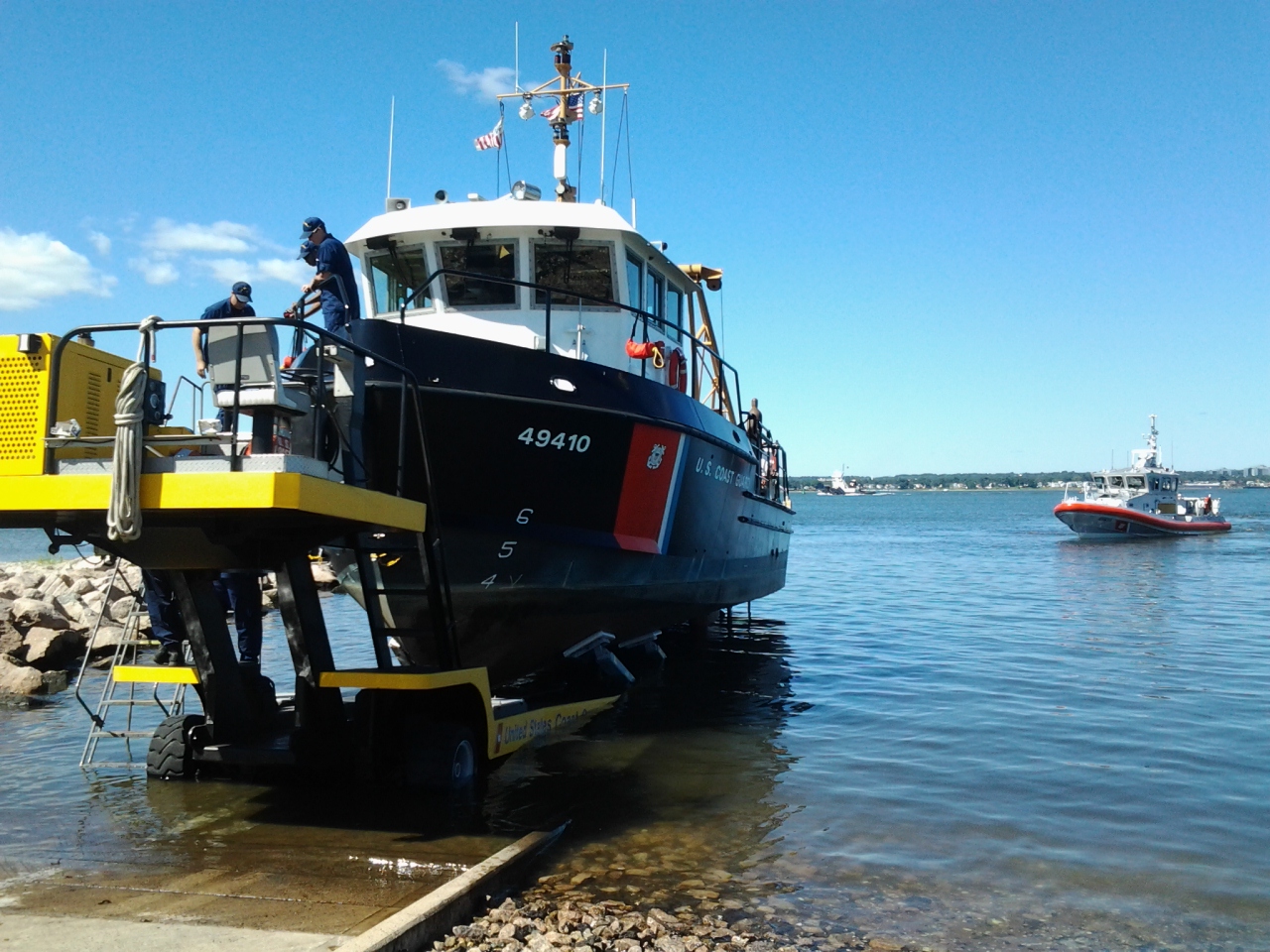
For many years, I've loved listening to Owl City; this affinity has carried down to my children who, along with me, particularly enjoy their latest album. While each song in the album is an excellent story in its own right, we all like the tale told in The Tornado. This led to my own recounting of a time, many years ago, when I experienced some extreme weather while aboard a Coast Guard buoy tender in the Long Island Sound. The kids, in their own manner of storytelling, have begun to tell this story as, "the time daddy was inside the middle of a tornado". While I may not have been in the very center of the storm, it may be fun to explore some historical data and see how close my boat was to the actual tornado.
The Tornado
On the afternoon of June 24th, 2010, an EF1 tornado made landing in Bridgeport, Connecticut 1. I was a young 3rd Class Electrician's Mate serving at the Aids to Navigation Team (ANT) Long Island Sound, based out of New Haven, CT. Having just reported to this unit the month prior, I was likely not qualified as the boat's engineer. This role was filled by the other EM3 at the unit. I don't recall the entire crew from this day, but I know we also had our Senior Chief as well as two other female crewmembers.
The responsibility of the unit is to manage and maintain lighthouses, small buoys and other navigational aids in the Long Island Sound (the body of water between Long Island, NY and the state of Connecticut). The job was extremely fun and rewarding, though also hard work. This particular unit had four boats at the time I served: two small 26' trailerable boats as well as two 49' buoy tenders.
A photo of the U.S. Coast Guard 49410, 49’ Buoy Tender from the author’s personal files. Photo taken Aug. 29th, 2012.
This particular day, we were on one of the 49' boats, though I do not remember exactly which one. I recall that we were sailing somewhere west of New Haven. Out of nowhere, the weather grew boisterous. This vessel can only make maybe 10 or 11 kts at the most, so we never got anywhere quickly. When the waves kicked up, whoever was at the helm gave control over to the Senior Chief. We didn't have enough power to direct the boat in any speciic direction, and all effort was made to simply keep the bow into the waves. Had we gotten beam-to (where the waves would hit directly at the side of the boat) it would have caused extreme rocking and would have been quite unstable and unpleasant – not to mention dangerous if we had any buoys on deck.
Eventually, the weather died down and I remember realizing that we had travelled quite close to the shore, but fortunately we came through the event without significant incident.
Fortunately, NOAA provides some historical maritime vessel traffic data2 and we can attempt to find out exactly what the track of our boat was on that day! We have to know that we were in UTM Zone 18 to download a zip file of GDB data, then load that up in one of my favorite geographic information systems ( GIS ) software: QGIS . It's a bit slow to filter down all of the available data.
All AIS tracks around Bridgeport, CT for the date of June 24th, 2010. Note the curious vessel movement near the center.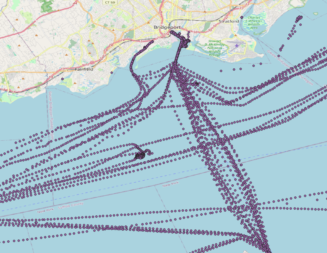
Unfortunately, the data doesn't actually show clear identification of the vessel. It's feasible that the boat didn't have its AIS transmitter on that day (though that would have been unusual). Perhaps any U.S. Coast Guard vessel data is deleted from the AIS database prior to uploading it to the NOAA website. It is interesting to see at least one track, just East of Stratford in the image above, which could correspond to a vessel during this storm. In fact, it very well could have been our boat, as I do recall ending up quite close to the shore when the storm had passed.
All AIS datapoints for the month of June, 2010 in New Haven Harbor. The U.S. Coast Guard Sector Long Island Sound is highlighted in red.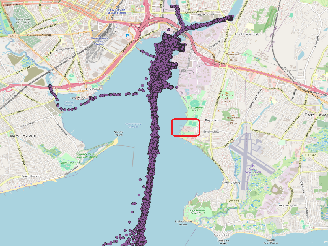
The theory that all military data was scrubbed from the database seems most likely, given further investigation. Looking at AIS data for the entire month of June, 2010 in New Haven shows zero data from the Coast Guard base, as highlighted above. Certainly there should be significant traffic from the base, so it seems that this is the reason we cannot find the vessel traffic we were looking for today.
Historical Weather Data
The tornado itself, according to TornadoArchive.com3 followed a path 100 yds wide and 0.2 miles long. The maximum winds were 110 mph.
Tornado track in Bridgeport, CT. Note the small blue line just north of I-95.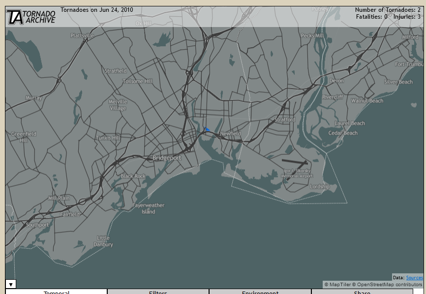
We can also look at historical weather radar data4 which shows a very strong system directly over Bridgeport at the reported time of tornado touchdown.
Weather radar from the time of tornado touchdown.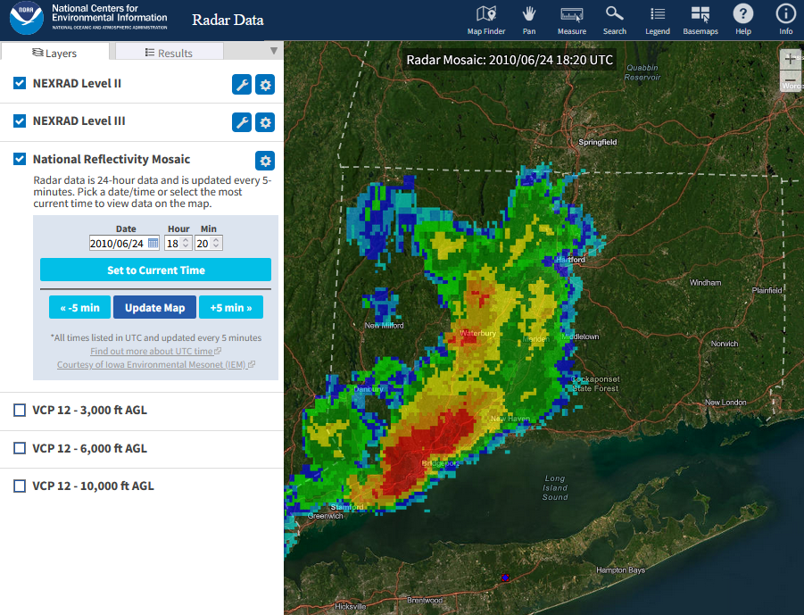
Conclusion
It would have been nice to find more conclusive data showing the boat I was on during this tornado. While I couldn't find anything exact, at the very least I can share my own memories of the event, combined with a bit of weather data, for others to read.
